Local History
Archaeology and early Land Management of Kings Norton Local Nature Reserve.
In medieval times the meadow-land around Merecroft Pool was part of two large granges belonging to the estate of Bordesley Abbey, near Redditch. During this period the land was known as 'Kingsack Farm' and was cultivated as “closes”.
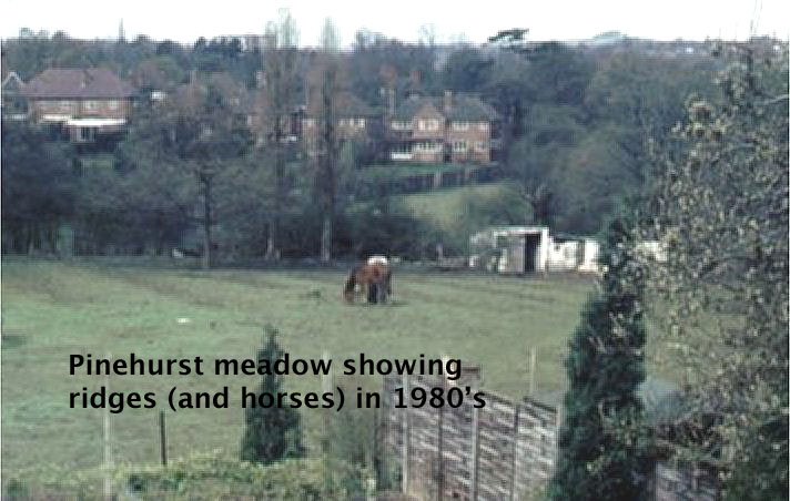
It is now thought the ridges and furrows visible on several meadows are not the result of medieval open-field cultivation, but more probably the result of 19th century ploughing.
Watermills and farms


Records show that a watermill stood on the Wychall Reservoir site as early as 1638. Remains of later mill structures are still visible along the eastern boundary of the reservoir site. These remains are listed as site no 03201 on the Birmingham Sites and Monuments Record. By the early 19th Century a rolling-mill stood on the site, powered by water drawn through a mill-race. This ran from Popes Lane, where water was taken from the river via a sluice, along the northern boundary of the reservoir and into the mill complex. The location is today the south western corner of Catesby Business Park. The mill stream once continued along the northern edge of the Wychall Meadows towards Westhill Road, following the line of the drainage ditch along the northern boundary. The mill site was later occupied by the Burmans factory, making gearboxes for motor vehicles.
Prior to the Enclosures period of the 18th Century the area surrounding the current Nature Reserve was low-lying wet meadow, which would have been used as grazing land for livestock. In 1774 an Enclosure Award was granted to the land including the meadows that surround Merecroft.
The first specific ownership records appear in 1844, when the Tithe Map and associated Appointment Documents were issued. These documents named Mr Robert Edward Eden Mynors as the owner of an area known as 'Long Meadow', which then included Merecoft. The land was managed and farmed by Mr John Phillips at New House Farm, on which the houses of Kingshill Drive now stand. Some old outbuildings remain, used for the horses which graze the meadows.
By 1884 the old 'Recreation Ground' beside Wychall Lane was managed as farmland with fields marked out by hedgerows. During the 1960s this area passed into the ownership of Birmingham City Council and has been managed as Public Open Space ever since.
Wychall Reservoir

Wychall Reservoir was originally constructed as a ‘compensation reservoir’ by the Worcester Canal Company in the early 19th century.
At that time the reservoir covered 6.72 hectares. The aim was to continue to provide water power for the surviving mills on the river Rea, before steam power was introduced to drive the machinery.
Birmingham City Council took ownership of the reservoir site during the early 1960s and managed the site as a Public Open Space. The surface area of the reservoir currently covers about 1% of its original size. This loss is largely due to the deliberate piercing of the dam by British Waterways in the mid-20th century, to obviate legal maintenance issues.
It is now managed by the Environment Agency merely as a flood defence facility. The height of the earth dam has been increased; storm water is retained for short periods only, before flowing back into the Rea. A small amount of dredging has taken place, and efforts are ongoing to increase the area of open water for wildlife, by reed cutting and the use of barriers of natural material.
The photo shows the old Triplex factory with the railway beyond, taken by Aerofilms in 1928 - Wychall reservoir can be seen in the foreground, along with the rolling mills.
(from ‘Britain from Above’, by English Heritage)

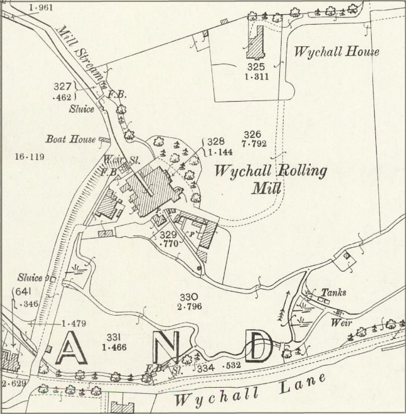
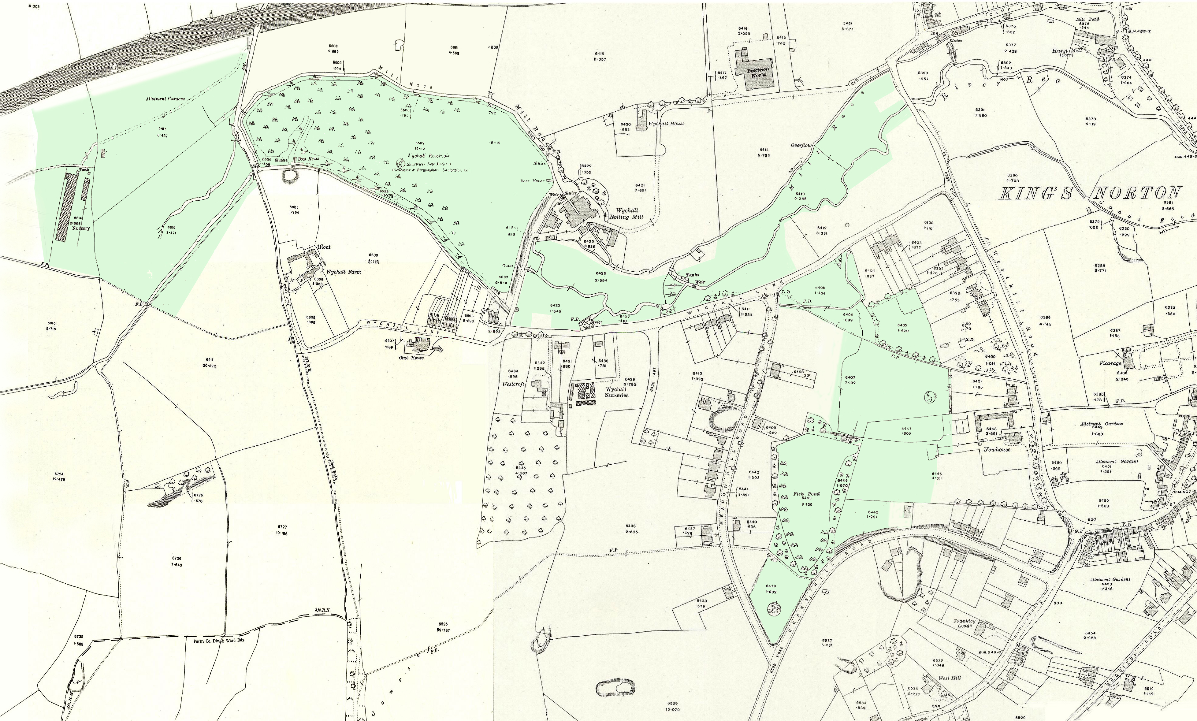
Ordnance Survey map of Kings Norton as it was in 1914. The railway line is seen at top left; the present area of the Nature Reserve is shown in green.
By 1884 the build-up of sediment in the reservoir and the process of secondary succession (growth of reeds and rough grass followed by willow woodland) had resulted in the loss of about one hectare of surface area. By 1904 another hectare had been lost, and a further hectare lost by 1936.
The Peafields
The Peafields in 1884 comprised two fields to the west of Popes Lane, belonging to Wychall Farm. The farm itself was on the site now occupied by St. Thomas Aquinas Catholic High School. By 1904 the northern half had become a nursery (Popes, specialising in daffodil culture) while the southern half remained as farmland. Birmingham City Council took ownership of the site in 1964, at which time the northern half was converted into public allotments. These allotments remained in use until the 1980s when the land was transferred to the Parks Department and managed as a Public Open Space.

Merecroft Pool

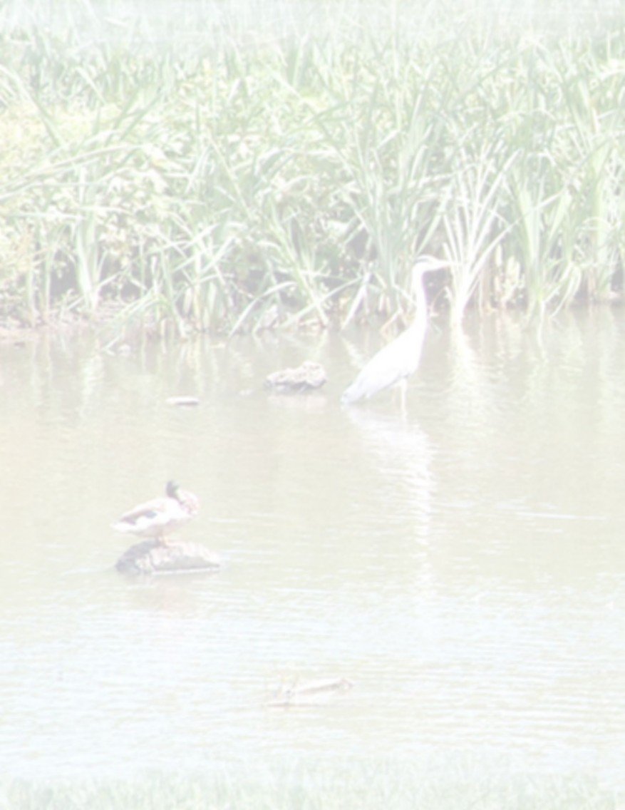
Merecroft Pool was created in about 1900 and is retained by an earth dam; it seems to have been a pleasure and boating lake, as can be seen from the photo. In the original image it is possible to make out the St. Nicolas church tower through the trees above the boat. On the skyline to the left, St Agnes Church, Cotteridge is also faintly seen, which dates the photo. The pool was once used by the City to re-stock fish for its other lakes. However, fishing is no longer permitted here! The lake is home to a colony of freshwater swan mussels. It provides a habitat for waterfowl including goosander, tufted duck, little egret, heron and swan, also pipistrelle and Daubenton's bats.
Several meadows including ‘Waterways’ are seen in this photo, looking south, again from the 1928 ‘Britain from Above’ collection; in the foreground is Triplex, and the railway. Kings Norton Park is at top left, Merecroft at top right; Wychall Lane is across the centre. A ring of Poplar trees at top centre enclose what is now Pinehurst meadow. The last poplar, now hollow, was felled in 2022.
